
Find Jefferson County Adjacent Parcels
The county viewer makes adjacency a manual task. Its Find control accepts Parcel_ID, Owner, or Address. Open the subject parcel first and note its identifiers. Then inspect the lots sharing its visible edges. If you started with an owner's name, switch to the mapped parcel before judging anything. One owner can hold several tracts, and a single tract can have multiple mapped components. Write down the tax year and neighborhood fields shown in the GIS service. Later comparisons should use the same layer.
Several records work together to map a block. The County Parcel Viewer advertises those Find controls. The parcel REST layer returns map number, parcel number, PIN, tax year, and links to deeds or map cards. The statewide assessment search adds a Street Name field. It can return multiple parcels along a road. A plat supplies lot and block context.
| Source | What It Shows About a Block | Access |
|---|---|---|
| Jefferson Parcel Viewer | Subject parcel and neighboring polygons | Find by Parcel_ID, Owner, or Address |
| Assessment search | Street Name and owner-name results by parcel | Statewide portal, Jefferson County selected |
| Parcel REST layer | Parcel ID, map number, tax year, deed/map links | Public ArcGIS service |
| Recorded plat | Subdivision lots, roads, and adjoining-lot context | Clerk plat search or Assessor map downloads |
These block sources identify parcels and record owners, not a roster of residents. The viewer offers no named buffer or select-by-location tool, so click polygons one at a time. Verify each one against the assessment roll.
Jefferson County Block Mapping Steps
A repeatable neighbor check follows a simple pattern. Identify one subject parcel. Zoom in until the parcel lines and road centerlines are distinct. List only the parcels touching its mapped perimeter, then use the parcel ID or map and parcel number to open each candidate record. Compare the map-card or deed links where available. The GIS layer caps any response at 1,000 records, so a very broad request can truncate results; work at a smaller extent and confirm every displayed neighbor belongs to the same tax year.
A known address is the easiest way to select the subject parcel. From there, read the parcel identifiers around its edge. The work stays parcel-by-parcel because the live viewer has no dedicated buffer or adjacent-parcel button. A street-name search can be faster for a long road, but compare its results on the map so a nearby road or a different municipality does not slip in by mistake.
Read a Jefferson County Block
Start with geography. Bring in the owner roll only after the parcel match is clear. Parcel numbers beat a neighbor's street name when lot lines curve, a road splits a block, or an address sits near a town boundary. Keep the subject parcel and each adjacent parcel ID noted as separate records.
- Search the subject address or Parcel_ID in the Jefferson County viewer.
- Use identify or click to note the parcel IDs that touch the subject polygon.
- Search each ID in the assessment portal and compare the parcel description.
- Use a recorded plat to check lot, block, easement, and road context.
- Parcel ID
- The map and assessment key used to find one tract.
- Adjacent parcel
- A mapped tract that touches another parcel boundary; a road or right-of-way may separate them.
- Plat
- A recorded map that names lots, roads, and subdivision features.
- Buffer
- A radius or distance query; the current viewer’s dedicated buffer tool was not verified.
Jefferson County Parcel IDs on the Block
The parcel layer also reports county, tax year, property type, and neighborhood. A shared neighborhood label does not mean two polygons touch. Parcels with the same label can sit on opposite sides of several streets. Let the map geometry decide adjacency. Then carry each map and parcel number into the related record. The address layer's municipality field offers another clue for telling similar street locations apart. However, it cannot replace the boundary view or prove a legal line.
The REST parcel schema exposes several fields. These include WVgovPid, WVgovPAR, PARID, Map_Number, Parcel_Num, PIN, TAX_YEAR, TaxReceipt, DeedLnk, and MapCardLnk. These fields shine after a map click. Each neighboring parcel can be carried into the state assessment search or the Clerk's index. Remember that a parcel number is a record key. It is not a legal conclusion about a shared boundary. For block-level data, the parcel service's visible schema stands as the strongest documented source.
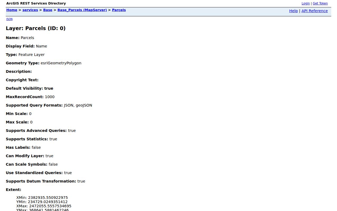
The layer supplies identifiers and links that support a map query, not a ready-made list of the owners surrounding any sample address.
Jefferson County Streets and Address Points
The county address layer carries plenty of detail. Full address, road, and municipality are standard fields. Emergency-service number, public safety answering point, MSAG community, master-street-addressing status, unit fields, and last update round it out. Set the address points over the parcel map. That helps separate a street-front address from a rear or shared access point. The layer has limits, though. It locates assigned addresses, not occupants. It says nothing about how a driveway easement is owned. Start road or response-area questions with the matching layer. Then confirm the current assignment with the responsible county or municipal office.
A street-name search returns the parcels along a road. That makes it handy for studying a whole block. Retired or odd address points appear sometimes. Compare those with the parcel polygon before deciding which Jefferson County parcel sits next door.
Jefferson County also links a 2001–2008 readdressing project and road indexes. Older road names and house numbers may not match today's address layer. For property research, treat the road layer as a locator only. Confirm the land description through the recorded plat or deed.
Jefferson County Plats and Shared Lines
Jefferson County's map catalog holds individual plat-book images alongside subdivision-development-pattern maps. For the legally filed drawing, turn to the Clerk's recording reference. Set the GIS line beside the recorded plat. Check lot labels, dimensions, road dedications, and easement notes. Parcels get divided over time. The tax map may then show more polygons than the original plat. Keep the current parcel IDs and the older book-and-page citation together, especially where a shared line follows a road, drainage course, or common access strip.
A recorded subdivision plat shows lot dimensions, roads, easements, and the relationship between adjoining lots at the time of filing. The County GIS catalog offers Plat Books 1 through 25 as TIF or JPG products. Viewer scale is not survey precision. Match the plat's book and page to the deed references on both sides. Streams, roads, and access strips separate polygons. Proximity alone will not settle ownership.
The Assessor offers the same plat books as downloads. The County Clerk links a plat search. A subdivision plat reveals lot order, streets, dedications, and easements behind what looks like one adjacent parcel on the map. The current zoning map was recorded in Plat Book 27, Page 651. The deed's legal description confirms which plat applies.
A mapped touch is not a shared boundary. A public road, stream, right-of-way, or recorded easement may lie between polygons. A GIS line is not a survey. Measure nothing off a screenshot. Where a boundary affects construction, access, or a dispute, consult the recorded deed and a licensed surveyor.
Jefferson County City-Line Checks
One block can cross a municipal line. Charles Town, Ranson, Harpers Ferry, Bolivar, and Shepherdstown keep their own planning and building records. Jefferson County holds the deeds and assessment records instead. A postal ZIP proves nothing about governance. Check the GIS municipality layer before reading a zoning map or requesting a permit history.
This is a boundary question, not a people-finder. Parcel geometry, town lines, plats, and road layers point to the right record custodian without assuming that nearby tax parcels follow the same rules.
Limits on Jefferson County Neighbor Lookup
Jefferson County offers no dedicated GIS buffer or select-by-location tool, so no portal result should be read as an official "within so many feet" search. A map shows adjacent parcel polygons. Household details, current occupancy, and willingness to be contacted are another matter. Parcel boundaries set no fence lines. They grant no right of way either. For a dispute or construction decision, trust the deed, recorded plat, applicable survey, and local permitting office over any measured screenshot.
A parcel record names an owner of record. It is not a census of nearby residents. Public maps help with land boundaries, road access, and civic research, but occupancy is beyond their reach. Occupancy questions need other sources. Because the GIS polygon is not survey-grade evidence, use an owner name only for a lawful property purpose.
Lawful use. Use a Jefferson County neighbor lookup for boundary, access, purchase, or civic questions. Do not use maps or owner records to watch, threaten, stalk, or harass anyone.