
Jefferson County Parcel Map Layers
The interactive viewer includes a Find function for Parcel_ID, Owner, or Address. The parcel service also returns the tax year. It links each polygon to several parcel identifiers, a deed record, and a map card. Treat each field as a pointer back to a separate public record. Keep the parcel ID. You will want it for later requests. One caution applies here. The parcel layer caps responses at 1,000 records. A broad query can look complete while missing parcels entirely. Narrow your search to a district, parcel, or small area before trusting the results.
The Jefferson County Parcel Viewer offers the same Find controls. County GIS stacks address, road, municipality, zoning, flood, and historic layers on the cadastral base. Layer names differ between the viewer and the REST services. Read each map as a set of records with separate custodians. No single viewer holds every property record.
| Layer | What It Shows | Use |
|---|---|---|
| Parcel polygons | Tax parcel geometry and identifiers | Locate the tract and nearby parcels |
| Address points | Full address, municipality, service fields, status | Resolve an address or jurisdiction question |
| Roads | Names, aliases, address ranges, route attributes | Match a road name to an assessment query |
| Municipal boundaries | Incorporated-town lines | Choose the permit and zoning office |
| Zoning and historic maps | Land-use classes and historic context | Research land use, not ownership |
| Flood and base imagery | Map context and visual reference | Orient a parcel; verify with responsible sources |
The parcel layer exposes WVgovPid, WVgovGen, WVgovPAR, PARID, Map_Number, Parcel_Num, PIN, TAX_YEAR, TaxReceipt, DeedLnk, and MapCardLnk. Those keys move you from geometry to evidence. Follow them into assessment, tax, and deed records. The Assessor maintains the parcel cadastral data. GIS/Addressing keeps the road and address layers. The ArcGIS parcel-layer record documents the fields behind Jefferson County's mapped parcels.
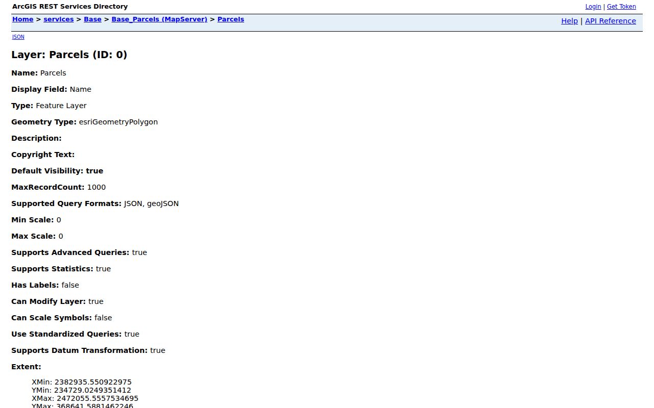
This schema is a route, not an answer. It connects a polygon to a parcel key, but it is not a populated owner card or a legal boundary survey.
Jefferson County Parcel Identifier Parts
The state assessment search accepts a Full Parcel ID or separate Map Number, Parcel, and Sub-Parcel entries. The local parcel layer also uses PARID, WVgovPid, WVgovPAR, Map_Number, Parcel_Num, and PIN. One parcel can therefore carry several related labels. Copy the complete form, including leading zeros and suffixes.
| District | County district used to narrow the assessment search |
|---|---|
| Map Number | Map component of the parcel key |
| Parcel | Parcel component tied to the tax map |
| Sub-Parcel | Additional component when the record has one |
| Legal description | Deed language that ties the key to a tract or platted lot |
Identifiers in a deed sometimes look different from the assessment search. Compare the district, map, parcel, and written land description before deciding the records disagree.
Jefferson County Plat Books and Maps
The County GIS catalog offers Plat Books 1 through 25 as TIF or JPG files. Finished tax maps ship as PDFs or one ZIP set. The Assessor site also links historic maps and a county GIS shapefile. The subdivision-development-pattern map is listed too. January 2026 road maps appear in the catalog as well. Older lot descriptions and road names get easier to decode with these files.
The 2025 zoning map was recorded on March 26, 2026, in Plat Book 27 at page 651. Book and page identify the source document. A plat lays out subdivision lots, roads, easements, and dedications. It is not a survey. Nor does it replace the deed's legal description.
Cite book and page in Clerk requests. Check the recording reference with the County Clerk when a legal copy matters. Maps point to sources. They do not prove lines. A current boundary survey settles what a plat cannot.
The County GIS map catalog names its plat, subdivision, zoning, and road-map products. Choose a source there. Compare it against the deed's legal description and recording reference.
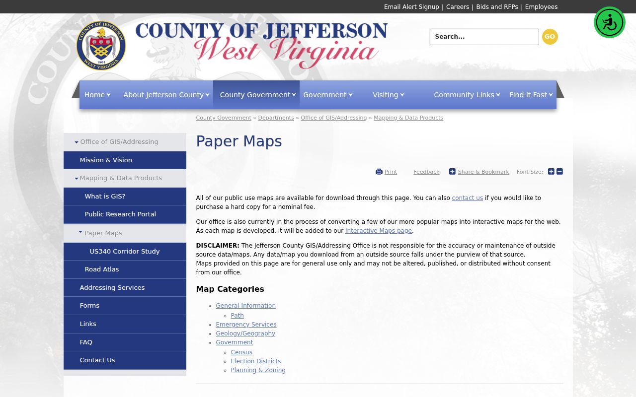
A catalog entry is a starting point. Match the map you choose against the deed's legal description and its recording reference.
Locate a Jefferson County Parcel
Use the Assessor's current parcel viewer, or its alternate. The Find control accepts Parcel_ID, Owner, or Address. An address that fails there still has options. Try the assessment search by Street Name, check the road index, and compare the address point's municipality and status. A ZIP or mailing city never proves the municipal boundary.
- Enter the address, owner, or Parcel_ID in the viewer’s Find control.
- Select the parcel polygon and note its identifier and map-card or deed link.
- Turn on road or municipal layers to check street names and city limits.
- Use the Assessor record and County Clerk instrument for ownership and legal-description details.
- Parcel ID
- The tax-map key that ties assessment and GIS records to a tract.
- Plat
- A recorded plan of lots, streets, and related land features.
- Lot and block
- A platted legal description that points to a named subdivision map.
- Metes and bounds
- A written description using courses, distances, landmarks, or adjoining tracts.
Limits of Jefferson County Parcel Maps
GIS geometry is a reference and tax layer. Use it to find a property or spot nearby parcel IDs. Use it to compare a map against a legal description. It does not establish the surveyed line on the ground. Zoning shows land-use classification, not present ownership. A flood or aerial layer is context rather than a final property determination.
Not a survey. Jefferson County parcel maps do not settle a boundary dispute. Use the deed and a licensed surveyor when placing improvements or resolving a line with a neighbor.
Jefferson County Address and Road Layers
Each address point carries a long attribute list. It includes Full Address, Full Road Name, unit fields, Municipality Name, Place Name, MSAG Community, ESN, and PSAP, plus address class, point type, capture method, status, and a last-update date, while the road layer holds aliases, left and right address ranges, county or state side, and route attributes. That mismatch is rarely an error. A street search, mailing city, or emergency-service label can disagree with the parcel map at first glance until you compare the underlying fields.
GIS/Addressing assigns county addresses and approves road names. It maintains signs and works with incorporated towns. Its files link to a 2001–2008 readdressing project, road indexes, and subdivision-name reservation forms. When a historic street number fails, search a current road name or ask Addressing to explain the assignment.
Jefferson County Municipal Map Lines
Municipal lines carry real permit consequences. Jefferson County building-code rules govern unincorporated land. Charles Town, Ranson, Harpers Ferry, Bolivar, and Shepherdstown run their own planning and building rules. A Charles Town mailing can sit outside the line. Skip the ZIP code. Use the municipality layer to find the office that controls zoning or a permit.
The map can also show city zoning, wards, growth sectors, or historic overlays when those layers are available. Zoning classifies land. It does not name the owner of record or approve a proposed use. For boundary or permit questions, ask the town for its controlling ordinance or decision record.
Jefferson County GIS Downloads
GIS data comes as shapefiles under the County's Data Usage Agreement. The county posts no complete fee schedule or guaranteed update interval for those downloads. Ask GIS staff about format, cost, and currency first. A download may capture one snapshot of the layer. It is not a current title record. Keep the layer name, tax year, download date, and agreement terms with the file so a later user can tell what the map represented.
The Assessor offers the complete county GIS shapefile. GIS/Addressing supplies a Data Usage Agreement and a Digital Data Order Form for its products. No current delivery fee or refresh date is posted. Public REST endpoints handle JSON and GeoJSON queries, statistics, pagination, SQL expressions, and distance queries. The parcel layer caps one response at 1,000 records. Check paging behavior before assuming a single reply holds every parcel.
For ordinary research, the interactive viewer and map downloads read more easily. Bulk users should review the data agreement. Note the layer's tax year and last-update fields too. A shapefile is a mapping resource. It is not a certified copy of a deed or plat.
Jefferson County Neighbor Parcels
The parcel viewer can show the polygons around a subject tract. Its REST layer can do the same. The county offers no named buffer or select-by-location tool. Click each neighbor to read its parcel ID. Then pull each parcel's record from the assessment roll for the details. A Street Name query can return a block.
A neighbor may sit across a road, stream, right-of-way, or municipal line. A map relation is only a lead, never a reason to target a person. The Jefferson County neighbor lookup explains that block-focused workflow and its limits.